NMB AsiaTownStreet Economics® Detections · Detection #2 on a network and a lineage · 163rd Street, North Miami Beach
Street Economics® · Detection #2

NMB AsiaTown

A network and lineage map of the Asian commercial district along 163rd Street in North Miami Beach: the grocers, kitchens, plazas, streets, civic bodies, events and precursors, how the district assembled itself, and what tends to happen after a district like it is seen.

Work in progress. This map is not exhaustive. It presents the result of documented research at this release and changes as sources are added, corrected, or superseded. Every node is based on at least one public source and carries its sources and confidence class. If something is missing or wrong, submit it.

Public disclosure policy: This map uses public business records, public corporate filings, property records, public calendars, public civic documents, public press coverage and public listings. It maps commercial infrastructure and documented civic activity, not endorsements, partnerships or private cultural behavior. Inclusion does not require participation, consent or approval. The map corrects factual errors promptly and considers removal requests case by case where a listing is outdated, an entity has closed, publication presents a material safety concern, or the entity is not conducting public facing commercial activity. Public commercial infrastructure is mappable; private cultural behavior is protected.
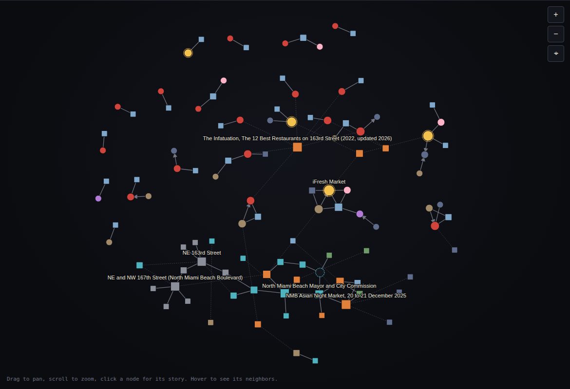
108 businesses, places, bodies and events · 105 connections · 11 layers of the place · 3 hub regions and 2 clusters
Version 1.2.0. Data current through 12 September 2026. Activity after that date is described as announced or scheduled, never as completed.
The network view of the interactive mapNetwork view. Three more: Lineage timeline, the street at parcel scale, and 3D, plus a Play animation from 1926 to 2026.

Read the reference

The same text as the PDF, generated from the same data file as the map, so the counts never disagree. This site is Street Economics® Detection #2.

Reading the mapA district is a network before it is a nameWhat the nodes and lines mean, the inclusion rules, timeline placement, the people rule, hub regions, the jurisdiction split and the eleven layers of the place.The districtHow it assembled itself, with no one's permissionHow the district assembled itself around its grocers, decade by decade, from the 1941 building on 163rd Street to the night markets, with the accretion curve.Current casesFour mechanismsFour mechanisms: the anchor grocer, the night market as recognition trigger, the built anchor against the organic cluster, and the North Miami counter case, with status as of the cutoff.RecognitionWhat the record shows the district being calledWhat the record shows the district being called, by whom and when, and what is not in the record.CatchmentWho came, and from whereThe Placer.ai catchment of the two night markets at ZIP level: who came, from where, when, and how it tightened toward local between December and May.ReferenceHow districts get seenNine organically formed Asian districts and five manufactured ones on eight milestones, the medians computed from the table, and where NMB AsiaTown sits.Network metricsWhat holds the district togetherDegree and betweenness computed on this dataset, on the full graph and on the location and lineage graph.MethodConfidence and sourcesConfidence grades, the evidence standard, the basemap and pin sources, hub regions, terminology, open items and the source register.AppendixIndex of nodesEvery business, place, body and event on the map, grouped by layer, each with its own entry.

Current cases: how a district gets seen

Four cases singled out because each shows a different mechanism. Node size and centrality are computed, not adjusted.

Anchor markets and grocers · 163rd Street east stripThe anchor grocer mechanismDaily traffic pulled by grocers, with kitchens and services held around them. Business tax record, geocoded inventory and computed betweenness.Events and recognition · 163rd Street east stripThe night market as recognition triggerTwo city hosted markets, December 2025 and May 2026. City record and the Placer.ai catchment at ZIP level.Plazas and property · 167th clusterThe built anchor versus the organic clusterMiami China City beside Little Saigon at the western end against the accreted 167th cluster. Property record and business tax dates.Precursors and counter cases · Outside the corridorThe counter caseNorth Miami's 2016 city branded Chinatown on NW 7th Avenue. The city's own record and press.

Eleven layers of the place

Every node belongs to one layer. Open any layer in the index of nodes.

Most connected in this dataset

Betweenness on the full graph: the nodes that bridge otherwise separate parts of the map. Full table and method.

  1. Chinatown designation of North Miami Beach Boulevard, 1 July 2015 (reported)event or recognition · betweenness 0.117
  2. City of North Miami Beachcivic body or program · betweenness 0.103
  3. New York Mart (551 NE 167th Street)business · betweenness 0.090
  4. iFresh Marketbusiness · betweenness 0.070
  5. North Miami Beach Mayor and City Commissioncivic body or program · betweenness 0.068
  6. The Infatuation, The 6 Best Asian Markets in Miami (2024)event or recognition · betweenness 0.065
  7. NE and NW 167th Street (North Miami Beach Boulevard)street or crossing · betweenness 0.048
  8. Beijing Martbusiness · betweenness 0.039

Data and downloads

The PDF reference, the Excel dataset and data.json, with the rules, the evidence standard and how to cite, on the data page.